It was reminiscent of a special edition from the Daily Planet: Extra! Extra! Read all about it, a new trail has been constructed in the
McDowell Sonoran Preserve (MSP)!!
Jeff laid claim as the town crier after he sampled the goods, 'discovering' the new trail during final approach last week.
A few others ventured out and a couple tantalizing photos of the contoured connector trail were published. Wow! This looks real nice. It also happens to be a sorely needed connector, bypassing a gated community who have become quite intolerant of cyclists over the past few years. Not to start a war or anything, but their gripe was with the road cycling community, not the stray mountain biker connecting MSP to
McDowell Mountain Regional Park.
I had to check it out for myself. Wednesday brought cool(er) weather, low 90's and I was free from my evening job. My plan was simple, start at the Lost Dog trailhead, climb the Sunrise trail to the new bypass at the top, descend the new trail to the end and return.
Here's what I found.
 |
| Lower flanks of Sunrise, the bypass creator is now sprucing up Sunrise trail. |
Just past the Ringtail trail junction I came across the bulldozer that cut in the bypass trail. Some 'lucky' driver had to navigate that thing down the Sunrise trail!! They were now in the process of cleaning up sections of Sunrise trail, performing erosion mitigation and adding a couple of short re-routes around sections of fall-line trail. To put this in better context, the photo below kind of sums it up.
 |
| Old Sunrise to the right, new Sunrise to the left. |
The lower half of Sunrise is strewn with loose rock, making the climbing quite difficult. It was rideable however, but you had to be on your game to pick the correct line. Now, there are sections of dirt sidewalk, no rocks whatsoever for a short bit, then back to the rubble. This toggles back and forth during the lower half of the climb. I really didn't mind it as it gave me a bit of a mental break while trying to catch my breath. The trail needed some work, in time the super smooth sections will rough up a bit.
 |
| The hitchin' post, signaling the start of the bypass route. |
 |
| Beginning of the bypass. |
 |
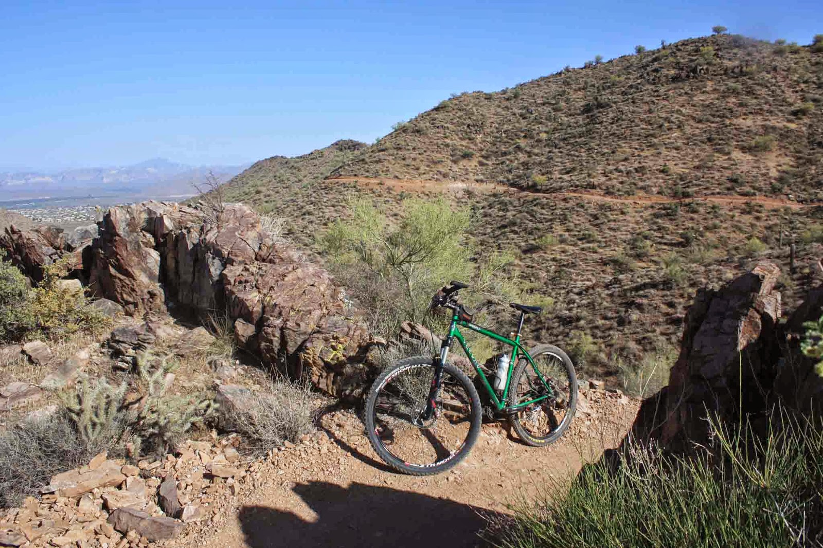
| Rounding the first turn, I had to stop. Look at the trail cut into the far mountain!! |
 |
| First wildlife sighting on the new trail....Gila Monster!!! |
 |
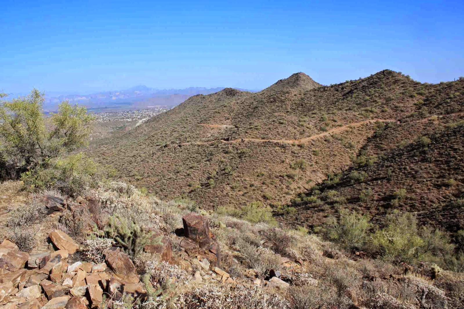
| The trail descends, then climbs to a saddle before making this long winding descent to the end. |
 |
| A look back. |
 |
| Some of the best views in the McDowell's can be seen from this trail. |
 |
| Stunning overlook high above Fountain Hills & Red Mountain. |
 |
| Sunrise Peak. |
My only beef with the trail was down at the terminus. The bypass tees into the Western Trail, which is mainly a hiking trail, but it appears they tried to make a rideable exit out onto the dirt road of the Promenade trail. It was rideable going down, but doubtful going back up due to the loose crushed granite surface. I opted to ride Promenade up a short grunt climb to the official entrance to the Western trail thus creating a short loop. While this bit was only 0.1 long it was mostly hike-a-bike back to the bypass.
I started back up the bypass enjoying the nice climbing grade. There are a few punchy sections thrown in just to see if you're paying attention, but otherwise it's a real nice climb with a few breaks thrown in.
 |
| A bit of exposure too. |
 |
| This trail is going to make some fun loops for bigger rides. |
Before long I was back at the top of Sunrise about to start a 2 1/2 mile bomber descent back to the car. Rolling into the trailhead I finally came upon another trail user, a lone hiker. Where was everyone? It was quite pleasant out with a comfortable breeze. Don't these people know our temperate days are numbered? If you're in the area and looking for a good ride, check this one out.

No comments:
Post a Comment